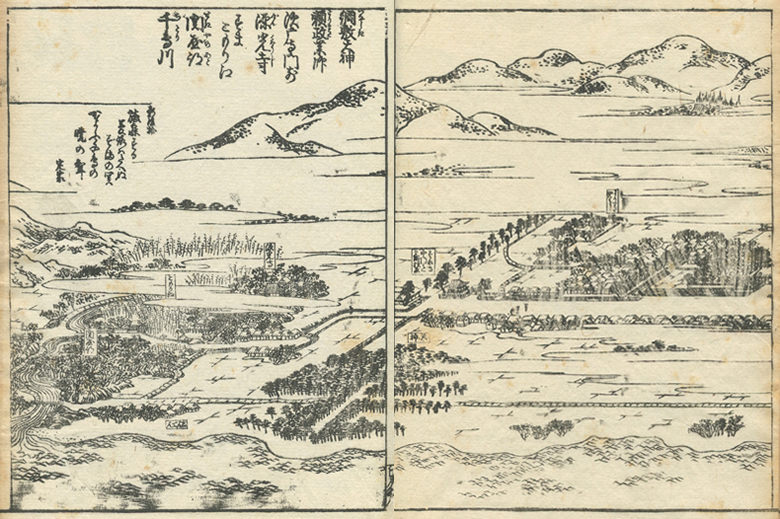
The Westernmost end of Suma is drawn.
It seems that the big highway extended from east and west breaks off, and a way becomes thin.
It seems that there is a shrine since the defeat-by-a-wide-margin valley has started with “Tenjin.”
There is “Genkouji” in the central left, it has hung further on the left with “the remains of Sekiya”, and this seems to be a sekimori Inari shrine.
Horizontally the river of “Chidori-gawa” is flowing and it is flowing into the sea.
It is thought that a mountain and trees are drawn in detail so that it may be shown from this that the west is a steep way.
from No. 4 of the bottom volume of the Settsu famous-place picture collection to No. 10.
須磨の西の端が描かれています。東西に伸びていた大きな街道が途切れ、道が細くなるようです。中押谷は「天神」とかかれているので神社があるようです。中央左には「源光寺」がありその更に左には「関屋跡」とかかれており、これは関守稲荷神社のようです。その横には「千鳥川」が流れており、海に注いでいます。これより西は険しい道であることを示すように、山や木々が詳細に描かれているように感じます。
摂津名所図会下巻の4から10まで続く長大な挿絵の一部です。

